|
 Geographic Information Systems (GIS) is a powerful computer mapping
technology that allows the merging of valuable database information with digital maps.
The digital maps can be "layered" on top of one
another while being linked to a database such as Access or
Oracle. And that information can be displayed in map or
report form. Geographic Information Systems (GIS) is a powerful computer mapping
technology that allows the merging of valuable database information with digital maps.
The digital maps can be "layered" on top of one
another while being linked to a database such as Access or
Oracle. And that information can be displayed in map or
report form. This system allows us to quickly and effectively display various sorts of
geographic data and other pertinent information in the form of maps overlaid on topographic maps and aerial photography.
There are several definitions of GIS. Some more technical
and complicated than others. I have found the definition
below to cover the definition of GIS fairly well.
"In
the strictest sense, a GIS is a computer system capable
of assembling, storing, manipulating, and displaying
geographically referenced information , i.e. data
identified according to their locations. Practitioners
also regard the total GIS as including operating
personnel and the data that go into the system."
http://info.er.usgs.gov/research/gis/title.html
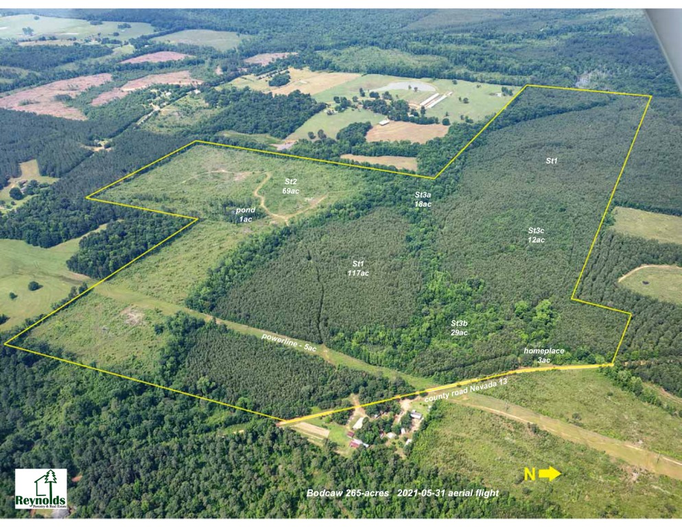
Aerial map with timber
stand boundaries If
you would like to learn more about GIS, GPS, mapping or
satellite imagery, visit the GIS links page. (click
here for GIS / mapping links) |